1. The Crucible of the North Atlantic
Along the rugged coastlines of Nova Scotia, New Brunswick, Prince Edward Island, and Newfoundland, winter brings some of the most violent extratropical cyclones on planet Earth. Known historically as Nor’easters due to the ferocious northeasterly gales that batter coastal harbors, these storms routinely attain central barometric pressures rivaling major Category 3 and Category 4 hurricanes (falling below 940 to 950 hectopascals).
Nor’easters unleash devastating hurricane-force wind gusts exceeding 140 to 180 km/h, catastrophic coastal storm surges that shatter seawalls and submerge harbors, blinding blizzard snowfalls exceeding 75 centimeters, and offshore wave heights surpassing 15 to 20 meters (50 to 65 feet) across the Grand Banks.
In January 2020, an explosive bomb cyclone struck Eastern Newfoundland in an event dubbed "Snowmageddon," burying St. John’s beneath 76.2 cm of snow in 24 hours under 157 km/h winds, prompting a municipal state of emergency that shut down the provincial capital for eight consecutive days.
2. The Bergeron Criterion: Defining Bomb Cyclogenesis
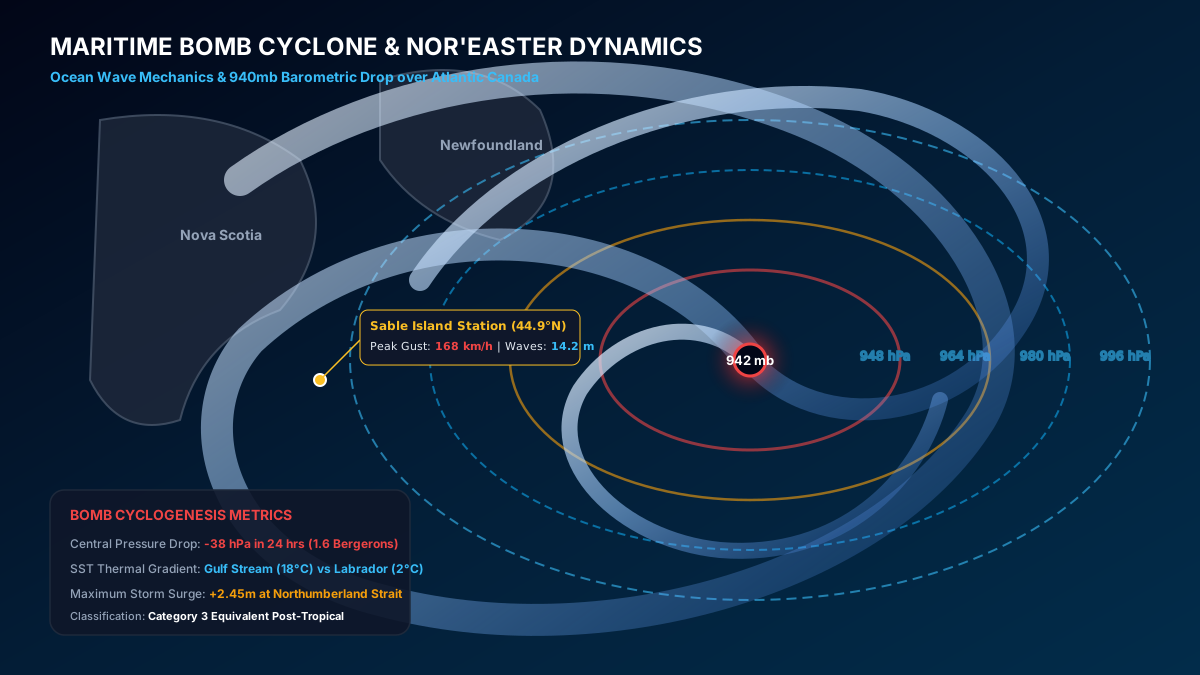
In synoptic meteorology, explosive cyclogenesis—commonly termed a "Bomb Cyclone"—is defined strictly by the rate of central barometric pressure drop. Established by legendary MIT meteorologist Tor Bergeron in 1980, the benchmark criterion requires a central pressure fall of at least 24 millibars (hPa) within a 24-hour period, adjusted for latitude.
At the latitude of Atlantic Canada (approx. 45°N to 50°N), the adjusted Bergeron threshold requires a pressure drop of approximately 21 to 24 hPa in 24 hours. During historic Atlantic bomb cyclones, storms routinely shatter this threshold, deepening by 35 to 50 hPa in 24 hours as they traverse the oceanic thermal collision zone.
3. The Thermal Engine: Gulf Stream Meets Labrador Current
Why does Atlantic Canada experience such ferocious cyclogenesis? The primary thermodynamic catalyst is the immense sea surface temperature (SST) contrast between two titanic oceanic currents.
To the south flows the warm, tropical waters of the Gulf Stream, carrying surface temperatures of +18°C to +24°C into the North Atlantic. Immediately adjacent to the north flows the sub-polar Labrador Current, carrying sub-zero Arctic meltwater (-1°C to +2°C) and pack ice down the coast of Newfoundland.
This establishes a hyper-intense oceanic thermal front spanning less than 200 kilometers. When cold continental air streams off the snow-covered Canadian Shield and crosses this oceanic thermal boundary, the explosive release of sensible heat and latent heat of condensation fuels intense vertical vorticity and rapid cyclone deepening.
Track coastal gales, marine tide surges, and Atlantic winter storm tracks.
Avalon Peninsula blizzard telemetry and hurricane-force marine winds.
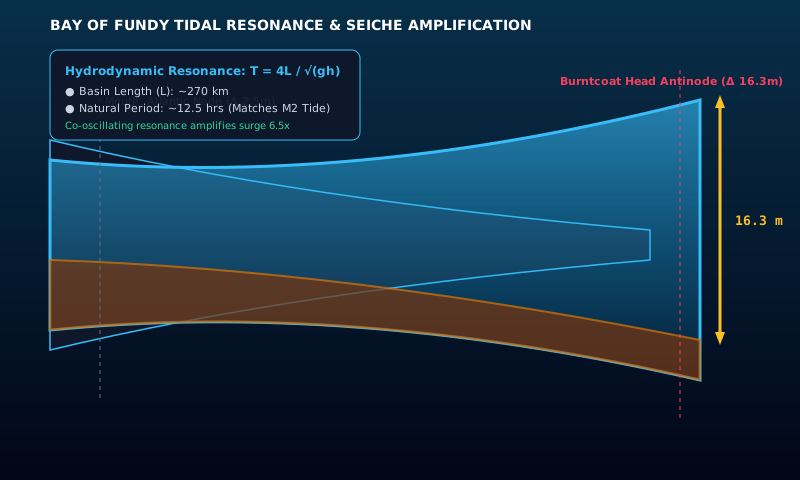
Calculate Bay of Fundy tidal resonance and storm surge heights.
Generate high-resolution emergency maritime departure packages.
Community Discussion & Field Reports
Share your on-the-ground observations, highway conditions, or questions with Canadian meteorologists.
The explanation of the -40°C wind chill boundary layer stripped by 50 km/h winds is spot on. We mandate emergency diesel fuel conditioners across all our trucks in Alberta whenever the ECCC polar vortex bulletin triggers.
Fascinating breakdown of the 1998 Ice Storm inversion sandwich compared to modern stratospheric warming lobes. The data tables on municipal frost depth are invaluable for city planning.
Having driven Highway 400 during single-band Georgian Bay lake squalls, the 13°C delta-T criterion explains why sunny skies turn into zero visibility in 200 meters. Excellent scientific journalism.