1. The Modern Canadian Wildfire Epoch
Across the 2.7 million square kilometers of Canada’s boreal forest, wildfire is an integral ecological renewal process. However, in recent decades, rising temperatures, prolonged drought cycles, and early spring snowpack disappearance have produced mega-fire events of unprecedented scale, intensity, and societal consequence.
The historic 2023 Canadian wildfire season burned an astounding 18.5 million hectares (over 45 million acres)—shattering the previous national record by more than double and emitting over 2 billion tonnes of CO₂ equivalent. Dense smoke plumes choked major Canadian metropolitan centres from Vancouver to Toronto and Montreal, while stratospheric smoke drifted thousands of kilometers across the Atlantic to Western Europe.
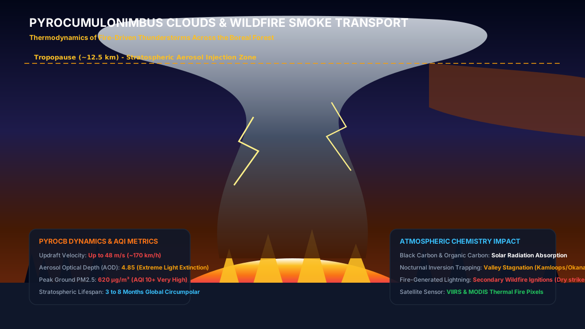
At the extreme apex of wildfire behavior lies one of the most violent and fascinating atmospheric phenomena in meteorological physics: the Pyrocumulonimbus (PyroCb) cloud—a fire-generated thunderstorm capable of injecting smoke aerosols directly into the stratosphere.
2. The Thermodynamic Engine: How Forest Fires Create Thunderstorms
A Pyrocumulonimbus cloud forms when an intense, high-intensity crown fire generates an enormous convective heat flux. Surface temperatures in the burning zone exceed 800°C to 1,000°C, heating the air immediately above the fire into an extreme thermal bubble.
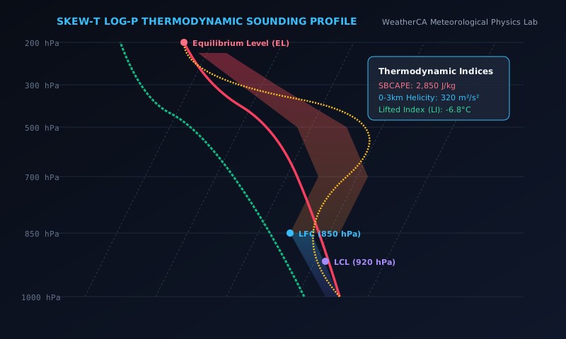
Because the burning of dry forest biomass (cellulose and lignin) releases vast quantities of water vapor through combustion chemistry, the rising updraft is intensely hot and rich in moisture. As this buoyant plume rockets upward at vertical velocities exceeding 30 to 50 m/s (100 to 180 km/h), it cools until it reaches its lifting condensation level.
The billions of microscopic smoke particles act as abundant cloud condensation nuclei (CCN). Condensation of water vapor releases immense latent heat, energizing the cloud to punch completely through the troposphere into the lower stratosphere at altitudes of 12 to 16 kilometers.
3. PM2.5 Aerosol Dynamics, Valley Inversions & The AQHI Scale
While PyroCb clouds generate headlines, the primary threat to human health is fine particulate matter with an aerodynamic diameter under 2.5 microns (PM2.5). These microscopic carbonaceous particles penetrate deep into human lung alveoli, entering the bloodstream and triggering severe cardiorespiratory distress.
In mountain valleys throughout British Columbia, Alberta, and the Yukon, nocturnal radiation inversions trap smoke particles under a sub-zero ceiling, causing PM2.5 concentrations to exceed 500 µg/m³—more than 50 times the World Health Organization annual safety threshold.
| AQHI Risk Level | Numerical Value | PM2.5 Concentration (µg/m³) | Public Health Action Recommendation |
|---|---|---|---|
| Low Risk | 1 - 3 | 0 - 12 | Ideal air quality for outdoor physical activities and recreation. |
| Moderate Risk | 4 - 6 | 13 - 35 | At-risk individuals (asthma, elderly, children) should monitor symptoms. |
| High Risk | 7 - 10 | 36 - 80 | Reduce strenuous outdoor activities; use HEPA air filtration indoors. |
| Very High / Extreme | 10+ (Off-Scale) | 81 - 500+ | Avoid all outdoor exertion; keep windows sealed; wear well-fitted N95 masks. |
Track active hot spots, satellite thermal anomalies, and PM2.5 air quality plumes.
Real-time AQHI measurements and hourly fine particulate concentrations.
Export raw historical smoke, temperature, and precipitation datasets.
Download backcountry wildfire evacuation routes and safety manuals.
Community Discussion & Field Reports
Share your on-the-ground observations, highway conditions, or questions with Canadian meteorologists.
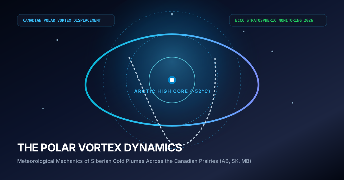
The explanation of the -40°C wind chill boundary layer stripped by 50 km/h winds is spot on. We mandate emergency diesel fuel conditioners across all our trucks in Alberta whenever the ECCC polar vortex bulletin triggers.
Fascinating breakdown of the 1998 Ice Storm inversion sandwich compared to modern stratospheric warming lobes. The data tables on municipal frost depth are invaluable for city planning.
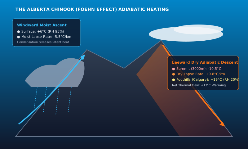
Having driven Highway 400 during single-band Georgian Bay lake squalls, the 13°C delta-T criterion explains why sunny skies turn into zero visibility in 200 meters. Excellent scientific journalism.